When I moved to my house in Alexandria on Fort Williams Parkway 26 (!) years ago, I was not very much into Civil War history. Sure, I knew there was a fort around here, but that was about it. And although this didn’t enter into our decision to buy our house, better a street named after Union fort than a Confederate officer—of which Alexandria has many, despite recent efforts to rename them.
Sixty-eight forts made up the Civil War Defenses of Washington. Worried about Confederate incursions into the nation’s capital, the Army built a circle of forts with other fortifications in between, making it the most protected city in the hemisphere, if not the world.
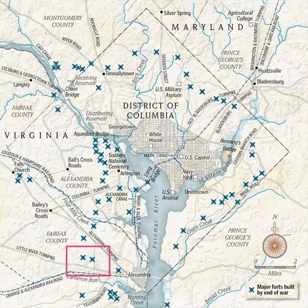
Map from National Park Service
Note the two forts that I marked inside the red rectangle. They are Fort Williams and Fort Worth, both within my 1970s-era neighborhood of Seminary Ridge, so named becuase it is (1) across from the Virginia Theological Seminary, and (2) on a ridgeline. Back then, the forts were strategically located between two east-west routes, the Alexandria Turnpike and the Little River Turnpike, and at an elevation high enough to view roads and railroad lines.
Fort Williams
Fort Williams (the right-hand little marker above) was built in 1862, partly on land owned by Col. Samuel Cooper, who resigned from the U.S. War Department to join the Confederacy. Thus, it became known as Traitor’s Hill. On May 30, 1863, Chief Engineer J.G. Barnard recommended the naming of a number of new forts, including:
That the new fort in progress on Traitor’s Hill, near Fort Worth, be called Fort Williams, after the late Brig. Gen. T. Williams, who was killed at the battle of Baton Rouge, La., August 5, 1862.
As far as I know, Williams did not have an Alexandria connection, but most of the forts were named after officers recently killed in battle, even if farther afield.
It had an earthwork enclosure that could accommodate thirteen pieces of artillery. Members of a Connecticut regiment, the 2nd Connecticut Heavy Artillery, helped build and man the fort. Other regiments rotated in and out.
Fort Worth
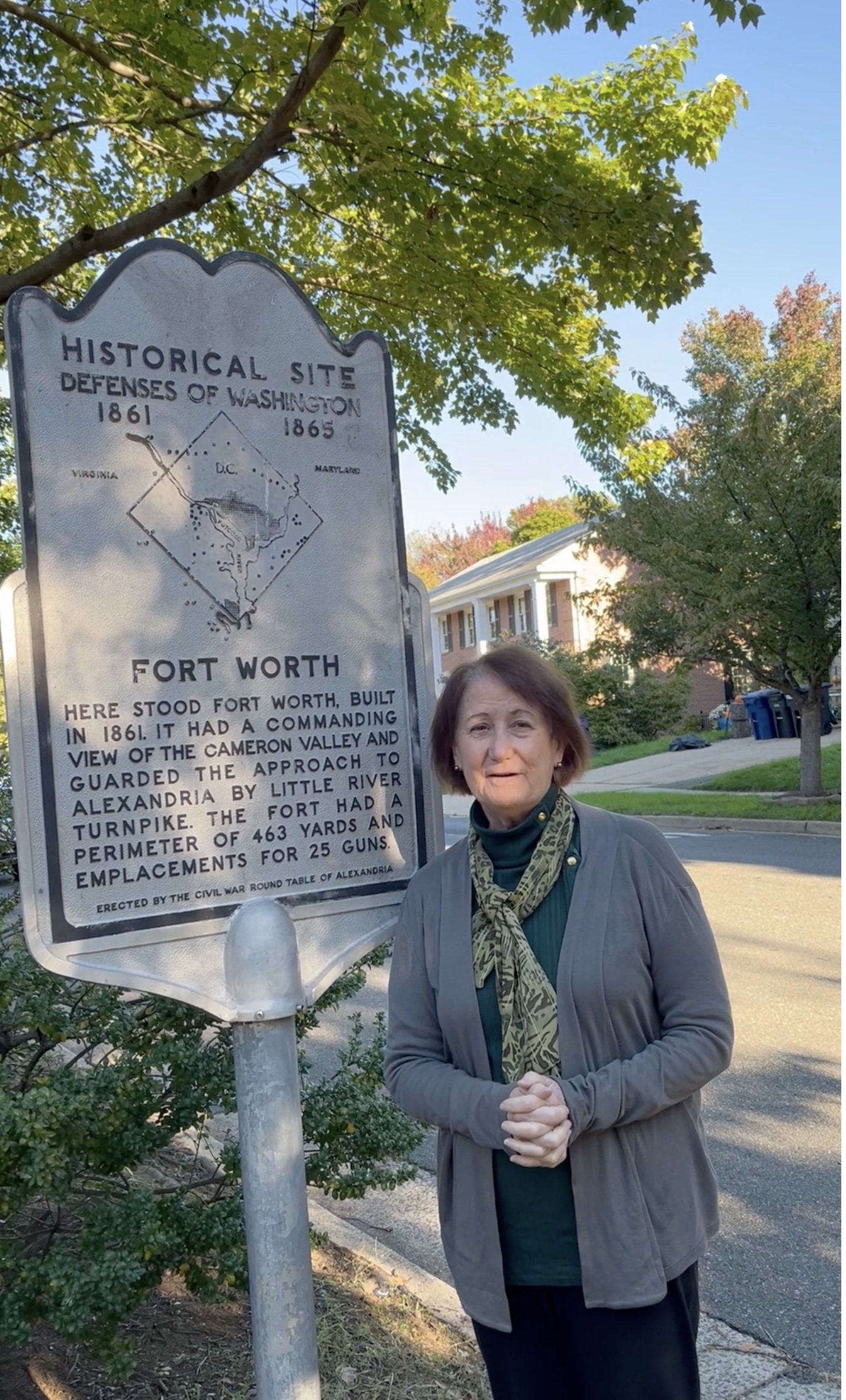
A few streets over is Fort Worth Avenue, named after Fort Worth, which in turn was named after Gen. William Jenkins Worth (who also lent his name to the Texas city).
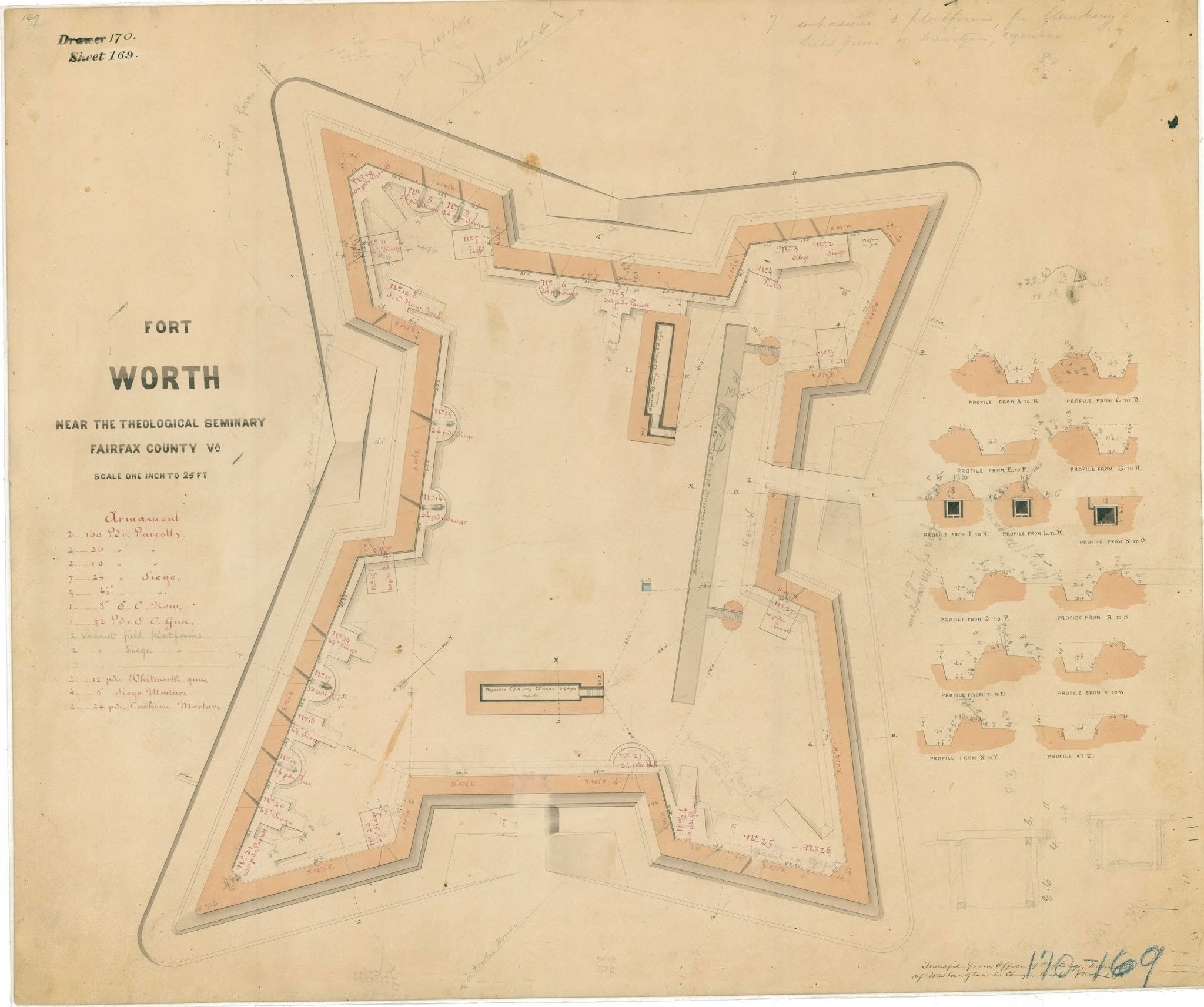
Fort Worth was shaped kind of like a rectangle with wings. One account said that the engineers wanted it to be larger but the land did not allow it.
An historical marker notes it “had a perimeter of 463 yards and emplacements for 25 guns,” thus about twice the size of Fort William.
Afterwards
The U.S. Army rapidly demobilized its expensive operations after the war. Men were mustered out. Materiel was auctioned off. On May 10, 1865, Lt. Col. B.F. Alexander assessed the forts “in order of their relative importance.” Fort Worth managed to retain “first class” importance but Fort Williams was relegated to “third class.” (Fort Worth soon slipped down, too.) There was much back and forth about what to do, but the bottom line, according to the Civil War Defenses of Washington Historic Resource Study, was
At those fortifications deemed expendable, the workforce removed pintle crosses, magazine lining, brass locks, hinges and sandbags; dismantled buildings, dismounted artillery, and collected tools and other engineer property and hauled them to one of the four engineer camps.
Fort Williams earthworks remain in the basement of a private residence (I have never seen them, just heard about them). A sliver of a park, as well as other homes in the area, no doubt have some remnants of this fort.
Fort Worth has no known remnants that I know of.
BUT…about a mile away, another fort, Fort Ward, is considered the most intact looking of the original forts and is open to the public.
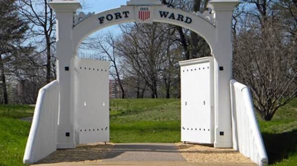
Recreated sign, Fort Ward Park, Alexandria
